Former Methodist Church, Kemble
Introduction
The photograph on this page of Former Methodist Church, Kemble by Jaggery as part of the Geograph project.
The Geograph project started in 2005 with the aim of publishing, organising and preserving representative images for every square kilometre of Great Britain, Ireland and the Isle of Man.

There are currently over 7.5m images from over 14,400 individuals and you can help contribute to the project by visiting https://www.geograph.org.uk
Former Methodist Church, Kemble
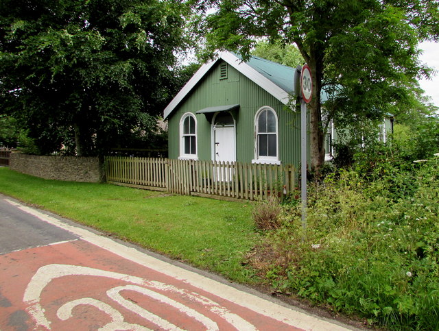
Image: © Jaggery Taken: 14 Jun 2015
In mid June 2015, the Washpool Lane corrugated metal building, formerly a Methodist Church, looks much improved from when I was last here in March 2012 http://www.geograph.org.uk/photo/2857070 which suggests that the building may now be in residential use, or perhaps a hall. There is no name on the building.
Images are licensed for reuse under creativecommons.org/licenses/by-sa/2.0
Image Location
Latitude
51.672761
Longitude
-2.011232