Wilmington House, 48 and 50 High Street, East Grinstead
Introduction
The photograph on this page of Wilmington House, 48 and 50 High Street, East Grinstead by Jo and Steve Turner as part of the Geograph project.
The Geograph project started in 2005 with the aim of publishing, organising and preserving representative images for every square kilometre of Great Britain, Ireland and the Isle of Man.

There are currently over 7.5m images from over 14,400 individuals and you can help contribute to the project by visiting https://www.geograph.org.uk
Wilmington House, 48 and 50 High Street, East Grinstead
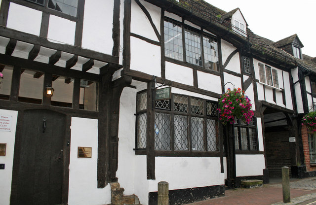
Image: © Jo and Steve Turner Taken: 20 Sep 2009
Two abutting Grade II Listed timber framed buildings. This western part of Wilmington House, 48 High Street, appears to date from the later 14th century.
Images are licensed for reuse under creativecommons.org/licenses/by-sa/2.0
Image Location
Latitude
51.123646
Longitude
-0.006294