West Float Remediation Project, Birkenhead
Introduction
The photograph on this page of West Float Remediation Project, Birkenhead by El Pollock as part of the Geograph project.
The Geograph project started in 2005 with the aim of publishing, organising and preserving representative images for every square kilometre of Great Britain, Ireland and the Isle of Man.

There are currently over 7.5m images from over 14,400 individuals and you can help contribute to the project by visiting https://www.geograph.org.uk
West Float Remediation Project, Birkenhead
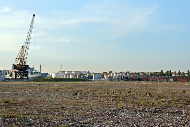
Image: © El Pollock Taken: 11 Jun 2015
The land has been cleared and recovered as a preliminary step for Peel Holdings' redevelopment of the site. In the meantime, a family of Canada geese has made it their home, along with plenty of seagulls beyond them. The ship to the left, behind the crane, is RFA Fort Rosalie (A385). On the opposite side of West Float is the United Molasses factory in Poulton.
Images are licensed for reuse under creativecommons.org/licenses/by-sa/2.0
Image Location
Latitude
53.40426
Longitude
-3.05061