Thrapston Bridge
Introduction
The photograph on this page of Thrapston Bridge by Bikeboy as part of the Geograph project.
The Geograph project started in 2005 with the aim of publishing, organising and preserving representative images for every square kilometre of Great Britain, Ireland and the Isle of Man.

There are currently over 7.5m images from over 14,400 individuals and you can help contribute to the project by visiting https://www.geograph.org.uk
Thrapston Bridge
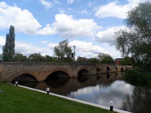
Image: © Bikeboy Taken: 30 May 2015
The bridge's age is uncertain. It's entry in British Listed Buildings http://www.britishlistedbuildings.co.uk/en-232485-thrapston-bridge-and-attached-causeway-t#.VXXMW89Viko is described as "Medieval origins, partly rebuilt and widened mid/late C18 and restored C19 and C20". There is documentary evidence of a bridge here as early as 1224 when Bishop Hugh Of Welles granted an indulgence to those offering money for its upkeep. http://www.british-history.ac.uk/vch/northants/vol3/pp139-142#highlight-first
Images are licensed for reuse under creativecommons.org/licenses/by-sa/2.0
Image Location
Latitude
52.396642
Longitude
-0.545419