St Mark's Church, Hamilton Terrace
Introduction
The photograph on this page of St Mark's Church, Hamilton Terrace by David Dixon as part of the Geograph project.
The Geograph project started in 2005 with the aim of publishing, organising and preserving representative images for every square kilometre of Great Britain, Ireland and the Isle of Man.

There are currently over 7.5m images from over 14,400 individuals and you can help contribute to the project by visiting https://www.geograph.org.uk
St Mark's Church, Hamilton Terrace
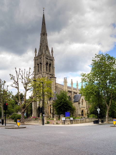
Image: © David Dixon Taken: 30 May 2015
St Mark's Hamilton Terrace was built in 1846, to the designs of Thomas Cundy (1790 - 1867), though the spire was added eighteen years later. Built to cater for large numbers of residents who came to live in the villas of the new suburb of St John's Wood, a previously rural fringe of London, it had seating for 1,450, with 1,000 rented seats and the rest free (the divisive practice of pew renting persisted in the Church of England well into the twentieth century, in some cases up to the Second World War). In October 1941, a bomb fell across the road and the force of the blast was such that the spire had to be taken down. It was rebuilt in 1955 (http://www.stmarks.me.uk/St_Marks/History.html St Mark’s history) St Mark’s is a Grade II* listed building (English Heritage Building ID: 210030 http://www.britishlistedbuildings.co.uk/en-210030-church-of-st-mark-greater-london-authori#.VXLVvmfbJ_s British Listed Buildings). Update: The church was gutted by a major fire in January 2023 https://www.geograph.org.uk/discuss/index.php?action=vthread&topic=33299
Images are licensed for reuse under creativecommons.org/licenses/by-sa/2.0
Image Location
Latitude
51.531821
Longitude
-0.182577