Polegate crossroads and carnival procession 2
Introduction
The photograph on this page of Polegate crossroads and carnival procession 2 by Andrew Huggett as part of the Geograph project.
The Geograph project started in 2005 with the aim of publishing, organising and preserving representative images for every square kilometre of Great Britain, Ireland and the Isle of Man.

There are currently over 7.5m images from over 14,400 individuals and you can help contribute to the project by visiting https://www.geograph.org.uk
Polegate crossroads and carnival procession 2
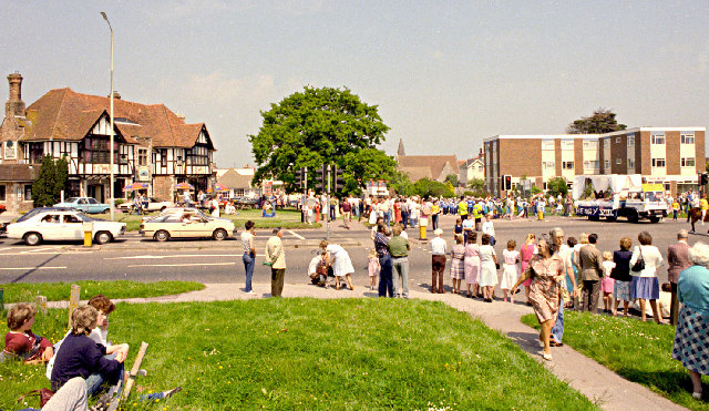
Image: © Andrew Huggett Taken: Unknown
Looking north-east towards Polegate High Street. The building on the left is the ‘Horse and Groom’ pub. The carnival procession has caused the police to close the busy main road through to Eastbourne which runs from left to right in the picture. July 1985.
Images are licensed for reuse under creativecommons.org/licenses/by-sa/2.0
Image Location


Leaflet Map data © OpenStreetMap
Latitude
50.818523
Longitude
0.240211