Milepost
Introduction
The photograph on this page of Milepost by Bob Harvey as part of the Geograph project.
The Geograph project started in 2005 with the aim of publishing, organising and preserving representative images for every square kilometre of Great Britain, Ireland and the Isle of Man.

There are currently over 7.5m images from over 14,400 individuals and you can help contribute to the project by visiting https://www.geograph.org.uk
Milepost
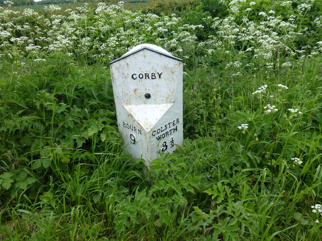
Image: © Bob Harvey Taken: 30 May 2015
To see this in context, see Image There has been some restoration since Image was taken. The left site reads 'Bourn 9', the right side 'Colsterworth 3 1/2' and the location is given as 'Corby', although the post is near the station rather than the village, about a mile distant. Note that Bourn is spelled without the terminal 'e', and 'Corby' is not 'Corby Glen'. The post predates both changes, in the case of Bourne by several decades, in the case of Corby Glen by over a century.
Images are licensed for reuse under creativecommons.org/licenses/by-sa/2.0
Image Location
Latitude
52.80732
Longitude
-0.544658