Birshaw Trig Pillar, Shaw
Introduction
The photograph on this page of Birshaw Trig Pillar, Shaw by michael ely as part of the Geograph project.
The Geograph project started in 2005 with the aim of publishing, organising and preserving representative images for every square kilometre of Great Britain, Ireland and the Isle of Man.

There are currently over 7.5m images from over 14,400 individuals and you can help contribute to the project by visiting https://www.geograph.org.uk
Birshaw Trig Pillar, Shaw
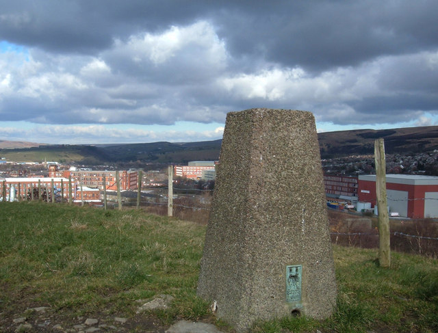
Image: © michael ely Taken: 28 Feb 2006
Located in a farmer's field just off the line of the Crompton Circuit footpath. It is at an elevation of 224 metres above sea level above the Beal Valley. Here we are looking north at what is left of Shaw's old cotton mills.
Images are licensed for reuse under creativecommons.org/licenses/by-sa/2.0
Image Location


Leaflet Map data © OpenStreetMap
Latitude
53.571538
Longitude
-2.092981