The line to Canterbury East
Introduction
The photograph on this page of The line to Canterbury East by Marathon as part of the Geograph project.
The Geograph project started in 2005 with the aim of publishing, organising and preserving representative images for every square kilometre of Great Britain, Ireland and the Isle of Man.

There are currently over 7.5m images from over 14,400 individuals and you can help contribute to the project by visiting https://www.geograph.org.uk
The line to Canterbury East
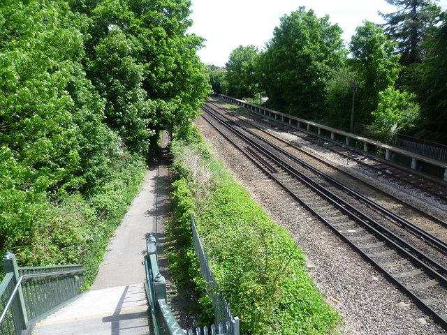
Image: © Marathon Taken: 28 May 2015
This view is from towards the southern end of the long footbridge over the railway lines between Faversham Recreation Ground and Preston Avenue. At first it passes over the line from Faversham to Whitstable and then the line from Faversham to Selling, Canterbury East and Dover Priory. This is the latter looking towards Selling. The line from Faversham to Canterbury East was opened on 9th July 1860 by the London, Chatham & Dover Railway.
Images are licensed for reuse under creativecommons.org/licenses/by-sa/2.0
Image Location
Latitude
51.30931
Longitude
0.899432