Knill's Monument
Introduction
The photograph on this page of Knill's Monument by Rude Health as part of the Geograph project.
The Geograph project started in 2005 with the aim of publishing, organising and preserving representative images for every square kilometre of Great Britain, Ireland and the Isle of Man.

There are currently over 7.5m images from over 14,400 individuals and you can help contribute to the project by visiting https://www.geograph.org.uk
Knill's Monument
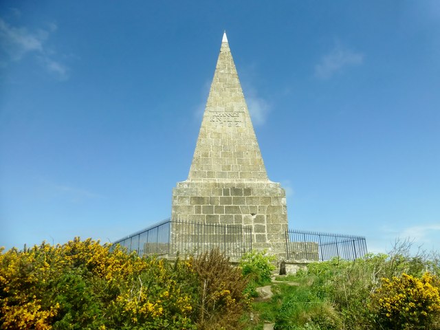
Image: © Rude Health Taken: 6 May 2015
A drive along narrow roads from Tink Hill. Parked near reservoir compound then gentle stroll to summit through the gorse. Name: Knill's Monument Hill number: 17666 Height: 170m / 558ft Parent (Ma/M): 2887 Watch Croft [White Downs] Section: 40: Cornwall & Devon County/UA: Cornwall (CoU) Class: Tump (100-199m) Grid ref: SW 51634 38672 Summit feature: ground at base of monument Drop: 37m Col: 133m SW507380
Images are licensed for reuse under creativecommons.org/licenses/by-sa/2.0
Image Location
Latitude
50.195741
Longitude
-5.481387