Eaton (aerial)
Introduction
The photograph on this page of Eaton (aerial) by Katy Walters as part of the Geograph project.
The Geograph project started in 2005 with the aim of publishing, organising and preserving representative images for every square kilometre of Great Britain, Ireland and the Isle of Man.

There are currently over 7.5m images from over 14,400 individuals and you can help contribute to the project by visiting https://www.geograph.org.uk
Eaton (aerial)
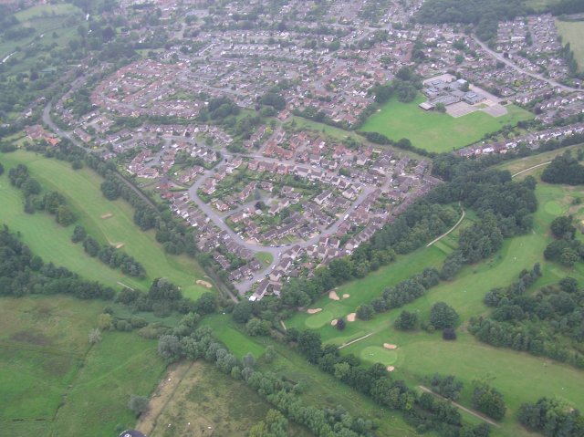
Image: © Katy Walters Taken: 20 Aug 2005
The bottom corner of the housing estate is at approx. TG213057, although the view encompasses more squares. Contents: Marston Marshes (bottom) - a publicly accessible nature reserve bordering the River Yare; Eaton Golf Club (fairways visible left and right); Fairways school and playing fields (upper right); part of the disused Civil Service Sports Ground (top right corner), soon to be developed for housing; River Yare (top left); housing estates (centre) dating from the 1970s and 1980s; Marston Lane (mid-left to bottom right) separates the golf course from the housing and the marshes, and is now a cycle/pedestrian path connecting Eaton to Ipswich Road.
Images are licensed for reuse under creativecommons.org/licenses/by-sa/2.0
Image Location


Leaflet Map data © OpenStreetMap
Latitude
52.603984
Longitude
1.266666