Archaeology on the site of Kentish Buildings (1)
Introduction
The photograph on this page of Archaeology on the site of Kentish Buildings (1) by Stephen Craven as part of the Geograph project.
The Geograph project started in 2005 with the aim of publishing, organising and preserving representative images for every square kilometre of Great Britain, Ireland and the Isle of Man.

There are currently over 7.5m images from over 14,400 individuals and you can help contribute to the project by visiting https://www.geograph.org.uk
Archaeology on the site of Kentish Buildings (1)
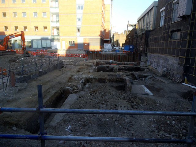
Image: © Stephen Craven Taken: 13 May 2015
A couple of peep holes in the hoardings around this site allowed a glimpse of the foundations of earlier buildings being studied by archaeologists before they were excavated for the foundations of the new development. See also Image, and Image for the buildings that used to be here.
Images are licensed for reuse under creativecommons.org/licenses/by-sa/2.0
Image Location
Latitude
51.503569
Longitude
-0.091052