Remains of St Etheldreda's church, Chesfield
Introduction
The photograph on this page of Remains of St Etheldreda's church, Chesfield by Bikeboy as part of the Geograph project.
The Geograph project started in 2005 with the aim of publishing, organising and preserving representative images for every square kilometre of Great Britain, Ireland and the Isle of Man.

There are currently over 7.5m images from over 14,400 individuals and you can help contribute to the project by visiting https://www.geograph.org.uk
Remains of St Etheldreda's church, Chesfield
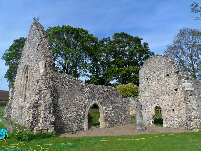
Image: © Bikeboy Taken: 10 May 2015
The church was dismantled in 1750 under license from the Bishop of Lincoln. It was built late C13/ early C14 although the first mention of a church at Chesfield is in 1232. It consists of a nave, chancel and south east chapel. The chapel can be seen in the right of the picture. The gabled west wall is on the left of the picture. The church is only about mile away from that of St Mary in Graveley and the two churches were united in 1445. There is no evidence of graves surrounding the church today but the churchyard was used until at least as late as 1686. See http://www.british-history.ac.uk/vch/herts/vol3/pp85-90#h3-0008 for details The statue to the right of the picture is of St Etheldreda by Mary Spencer Watson (1914-2006) in 1982.
Images are licensed for reuse under creativecommons.org/licenses/by-sa/2.0
Image Location
Latitude
51.935266
Longitude
-0.186249