Former Railway Bridge
Introduction
The photograph on this page of Former Railway Bridge by Anne Burgess as part of the Geograph project.
The Geograph project started in 2005 with the aim of publishing, organising and preserving representative images for every square kilometre of Great Britain, Ireland and the Isle of Man.

There are currently over 7.5m images from over 14,400 individuals and you can help contribute to the project by visiting https://www.geograph.org.uk
Former Railway Bridge
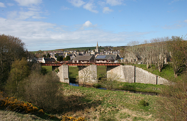
Image: © Anne Burgess Taken: 7 May 2015
The bridge was built to carry the railway from Ellon to Fraserburgh across the North Ugie Water. The railway route is now the Formartine and Buchan Way.
Images are licensed for reuse under creativecommons.org/licenses/by-sa/2.0
Image Location
Latitude
57.584651
Longitude
-2.091801