Crabley Creek
Introduction
The photograph on this page of Crabley Creek by Paul Glazzard as part of the Geograph project.
The Geograph project started in 2005 with the aim of publishing, organising and preserving representative images for every square kilometre of Great Britain, Ireland and the Isle of Man.

There are currently over 7.5m images from over 14,400 individuals and you can help contribute to the project by visiting https://www.geograph.org.uk
Crabley Creek
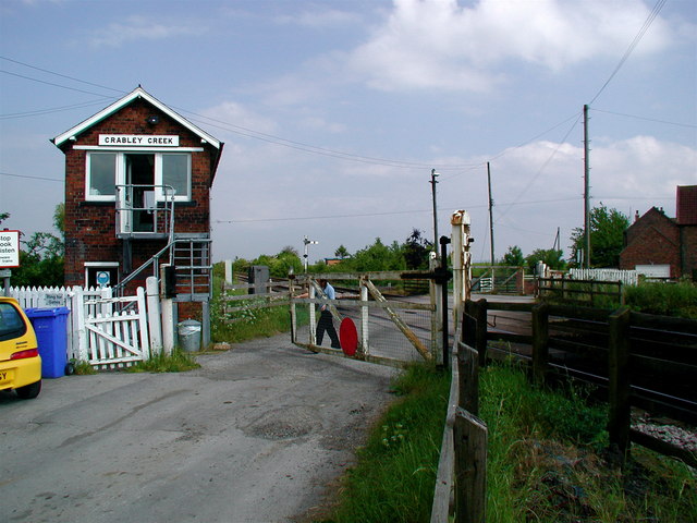
Image: © Paul Glazzard Taken: 24 May 2007
Manned level crossing at Crabley Creek. It's being operated by a woman, but somehow 'womanned level crossing' doesn't sound right. It seems strange to me that the crossing is manned as the road leads to Crabley Farm just beyond the tracks and to nowhere else. I'm pretty sure this is in South Cave although the parish boundaries around here are ridiculously complicated.
Images are licensed for reuse under creativecommons.org/licenses/by-sa/2.0
Image Location
Latitude
53.734993
Longitude
-0.631818