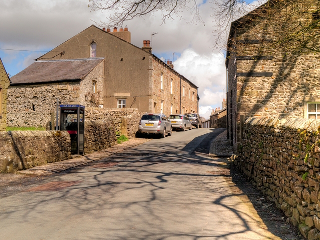
Slaidburn, Church Street
Introduction
The photograph on this page of Slaidburn, Church Street by David Dixon as part of the Geograph project.
The Geograph project started in 2005 with the aim of publishing, organising and preserving representative images for every square kilometre of Great Britain, Ireland and the Isle of Man.
There are currently over 7.5m images from over 14,400 individuals and you can help contribute to the project by visiting https://www.geograph.org.uk

Image: © David Dixon Taken: 7 May 2015
Slaidburn is a small rural village situated at the confluence of the Croasdale Brook and the River Hodder on the B6478 road from Clitheroe to Long Preston in the Forest of Bowland Area of Outstanding Natural Beauty. The character of the village is that of a post medieval settlement, with some 17th century houses, and a number dating to the 18th century. Most of the houses date to the early 19th century. The village has remained remarkably unspoilt by modern development. It is characterised by rows of cottages, mainly two-up, two-down which open directly onto the street. These would have been built as dwellings for agricultural workers or handloom weavers. The modern telephone kiosk on Church Street is, however, in contrast to the rows of cottages on either side of the street (the one on the left, dated 1810, is a grade II listed building, English Heritage Building ID: 183138 http://www.britishlistedbuildings.co.uk/en-183138-18-and-20-church-street-slaidburn-lancas#.VU39imd0x_s ).

