Old house at Upper Houses Farm
Introduction
The photograph on this page of Old house at Upper Houses Farm by Robert Graham as part of the Geograph project.
The Geograph project started in 2005 with the aim of publishing, organising and preserving representative images for every square kilometre of Great Britain, Ireland and the Isle of Man.

There are currently over 7.5m images from over 14,400 individuals and you can help contribute to the project by visiting https://www.geograph.org.uk
Old house at Upper Houses Farm
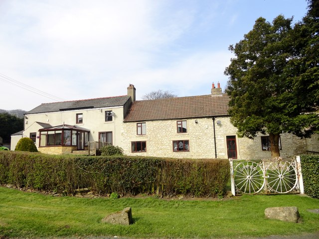
Image: © Robert Graham Taken: 10 Apr 2015
I believe this was the original farmhouse for this farm. It probably dates from the early 19th century. A new farmhouse was built in the 20th century to replace it, and this building converted into a residential property. Originally, the right hand section would have been agricultural, possibly a byer.
Images are licensed for reuse under creativecommons.org/licenses/by-sa/2.0
Image Location
Latitude
54.816019
Longitude
-1.77122