The Old School House, Lower Peover
Introduction
The photograph on this page of The Old School House, Lower Peover by Bikeboy as part of the Geograph project.
The Geograph project started in 2005 with the aim of publishing, organising and preserving representative images for every square kilometre of Great Britain, Ireland and the Isle of Man.

There are currently over 7.5m images from over 14,400 individuals and you can help contribute to the project by visiting https://www.geograph.org.uk
The Old School House, Lower Peover
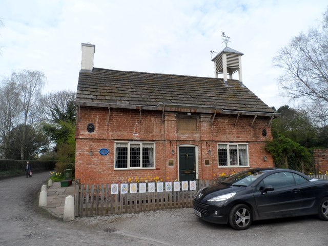
Image: © Bikeboy Taken: 16 Apr 2015
Built in 1645 and altered in 1710. See http://www.geograph.org.uk/photo/4463828 for a close-p of the plaque above the door. The blue plaque on the left was added in 2010 commemorating 300 years of the founding of the school in 1710 by Richard Cumberbach. See http://www.britishlistedbuildings.co.uk/en-57610-the-old-school-house-nether-peover-#.VUpzg_lViko for entry in British Listed Buildings.
Images are licensed for reuse under creativecommons.org/licenses/by-sa/2.0
Image Location
Latitude
53.263806
Longitude
-2.387502