Over the A4, Under the M4
Introduction
The photograph on this page of Over the A4, Under the M4 by David Dixon as part of the Geograph project.
The Geograph project started in 2005 with the aim of publishing, organising and preserving representative images for every square kilometre of Great Britain, Ireland and the Isle of Man.

There are currently over 7.5m images from over 14,400 individuals and you can help contribute to the project by visiting https://www.geograph.org.uk
Over the A4, Under the M4
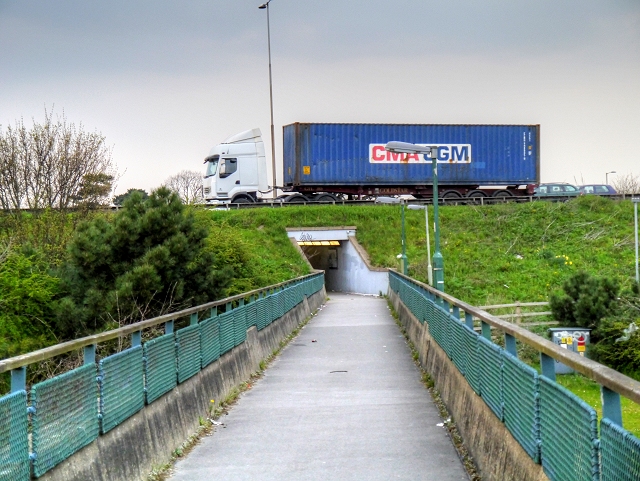
Image: © David Dixon Taken: 8 Apr 2015
The complex pedestrian bridge to cross junction 5 of the M4 at Langley goes over the first part of the roundabout (A4), from where this photograph was taken. Ahead, it becomes a subway under the M4 and, on emerging at the other side, it is a bridge again crossing the other side of the roundabout.
Images are licensed for reuse under creativecommons.org/licenses/by-sa/2.0
Image Location
Latitude
51.491701
Longitude
-0.542278