Houses at the former Greensyke Farm
Introduction
The photograph on this page of Houses at the former Greensyke Farm by Rose and Trev Clough as part of the Geograph project.
The Geograph project started in 2005 with the aim of publishing, organising and preserving representative images for every square kilometre of Great Britain, Ireland and the Isle of Man.

There are currently over 7.5m images from over 14,400 individuals and you can help contribute to the project by visiting https://www.geograph.org.uk
Houses at the former Greensyke Farm
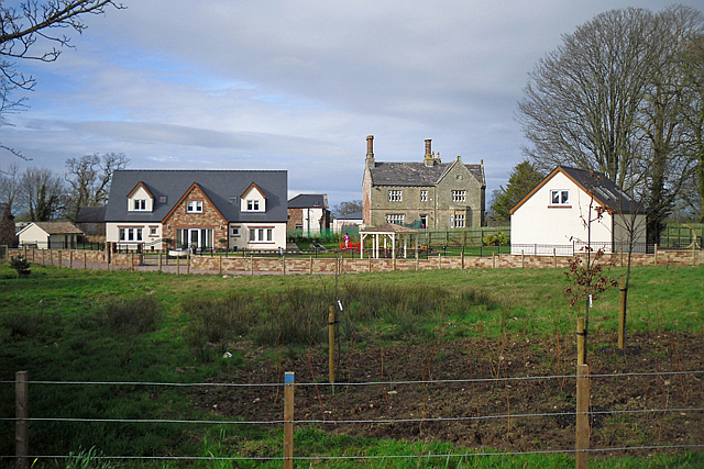
Image: © Rose and Trev Clough Taken: 4 Apr 2015
A recently built luxury home on the left, a restored Victorian mansion (Greensyke House) on the right. Redevelopment of the site for housing began in 2012. During the 1990s Greensyke Farm was used as an annexe to Lime House School. From 2002 the site was occupied by the Kingswood Outdoor Education Centre (the subject of a protracted planning dispute) which closed in 2009. For a view of the grounds in 2011, see Image .
Images are licensed for reuse under creativecommons.org/licenses/by-sa/2.0
Image Location
Latitude
54.82599
Longitude
-3.006415