Boardwalk on the Wales Coast Path, Margam Moors
Introduction
The photograph on this page of Boardwalk on the Wales Coast Path, Margam Moors by eswales as part of the Geograph project.
The Geograph project started in 2005 with the aim of publishing, organising and preserving representative images for every square kilometre of Great Britain, Ireland and the Isle of Man.

There are currently over 7.5m images from over 14,400 individuals and you can help contribute to the project by visiting https://www.geograph.org.uk
Boardwalk on the Wales Coast Path, Margam Moors
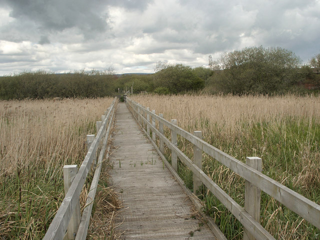
Image: © eswales Taken: 30 Apr 2015
This boardwalk across a wetland area of reeds and other grasses lies on a stretch of the Wales Coast Path between the River Kenfig crossing and Margam which opened some time after much of the rest of the path. One internet source indicates that this stretch may have opened in March 2014. A good part of it is taken up with a crossing of the reclaimed land of Margam Moors, where this picture was taken.
Images are licensed for reuse under creativecommons.org/licenses/by-sa/2.0
Image Location
Latitude
51.543225
Longitude
-3.746971