Main Street, Wetwang
Introduction
The photograph on this page of Main Street, Wetwang by Paul Harrop as part of the Geograph project.
The Geograph project started in 2005 with the aim of publishing, organising and preserving representative images for every square kilometre of Great Britain, Ireland and the Isle of Man.

There are currently over 7.5m images from over 14,400 individuals and you can help contribute to the project by visiting https://www.geograph.org.uk
Main Street, Wetwang
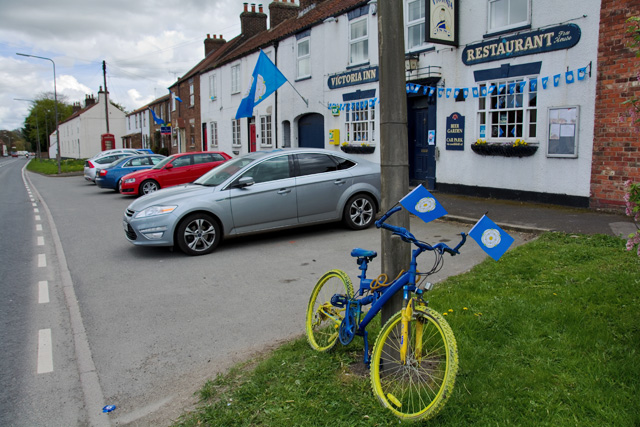
Image: © Paul Harrop Taken: 1 May 2015
The south side of the A166 as it runs through the village. The blue and yellow bike is one of many adorning roadsides in the area, to mark the route of the Tour De Yorkshire bicycle race which passed through the area the day after this picture was taken.
Images are licensed for reuse under creativecommons.org/licenses/by-sa/2.0
Image Location
Latitude
54.018983
Longitude
-0.580999