Comber Greenway
Introduction
The photograph on this page of Comber Greenway by Robert Ashby as part of the Geograph project.
The Geograph project started in 2005 with the aim of publishing, organising and preserving representative images for every square kilometre of Great Britain, Ireland and the Isle of Man.

There are currently over 7.5m images from over 14,400 individuals and you can help contribute to the project by visiting https://www.geograph.org.uk
Comber Greenway
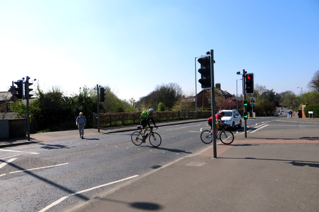
Image: © Robert Ashby Taken: 22 Apr 2015
The cycle and pedestrian crossing, of the type named Puffin crossings, on the Kings Road. The railway line at this point went through a tunnel under the road and I remember back about 1954 standing on the bridge, just to the right of the cyclists position, watching the lifting of the track below. The tunnel has long since been blocked off.
Images are licensed for reuse under creativecommons.org/licenses/by-sa/2.0
Image Location
Latitude
54.590656
Longitude
-5.851812