Botesdale, Redgrave and The Rickinghalls War Memorial
Introduction
The photograph on this page of Botesdale, Redgrave and The Rickinghalls War Memorial by Adrian S Pye as part of the Geograph project.
The Geograph project started in 2005 with the aim of publishing, organising and preserving representative images for every square kilometre of Great Britain, Ireland and the Isle of Man.

There are currently over 7.5m images from over 14,400 individuals and you can help contribute to the project by visiting https://www.geograph.org.uk
Botesdale, Redgrave and The Rickinghalls War Memorial
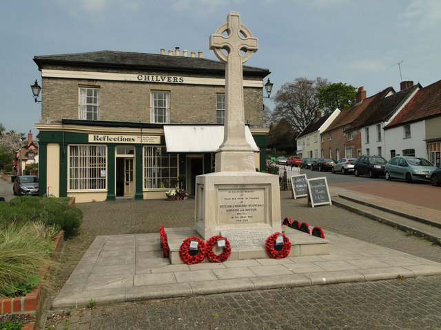
Image: © Adrian S Pye Taken: 24 Apr 2015
The memorial covers four parishes, Botesdale where it is situated centrally, Redgrave, the adjoining village to the north, Rickinghall Superior and Rickinghall Inferior on the south and west. There are 61 names on the memorial for WW1 and a further 6 for WW2 with one name listed for the Korean War.
Images are licensed for reuse under creativecommons.org/licenses/by-sa/2.0
Image Location
Latitude
52.342327
Longitude
1.004341