Milton Abbot
Introduction
The photograph on this page of Milton Abbot by Derek Harper as part of the Geograph project.
The Geograph project started in 2005 with the aim of publishing, organising and preserving representative images for every square kilometre of Great Britain, Ireland and the Isle of Man.

There are currently over 7.5m images from over 14,400 individuals and you can help contribute to the project by visiting https://www.geograph.org.uk
Milton Abbot
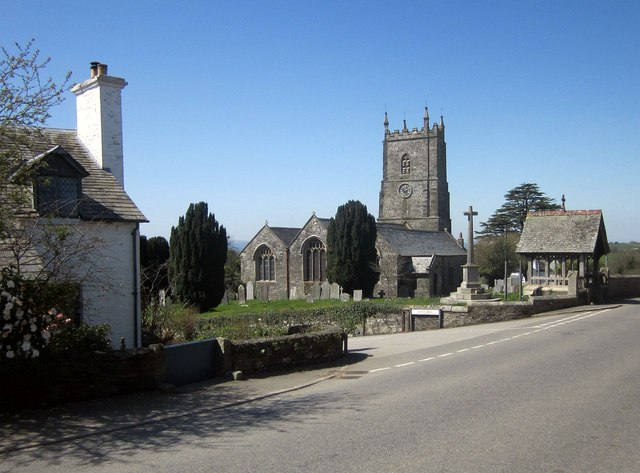
Image: © Derek Harper Taken: 14 Apr 2015
The grade I listed church of St Constantine is also shown in Image, and described in detail at http://list.historicengland.org.uk/resultsingle.aspx?uid=1326349&searchtype=mapsearch . On the left is No 2, Dukes Cottages http://list.historicengland.org.uk/resultsingle.aspx?uid=1105550&searchtype=mapsearch . The lychgate is described at http://list.historicengland.org.uk/resultsingle.aspx?uid=1165487&searchtype=mapsearch .
Images are licensed for reuse under creativecommons.org/licenses/by-sa/2.0
Image Location
Latitude
50.591466
Longitude
-4.251491