Polegate Windmill
Introduction
The photograph on this page of Polegate Windmill by Andrew Huggett as part of the Geograph project.
The Geograph project started in 2005 with the aim of publishing, organising and preserving representative images for every square kilometre of Great Britain, Ireland and the Isle of Man.

There are currently over 7.5m images from over 14,400 individuals and you can help contribute to the project by visiting https://www.geograph.org.uk
Polegate Windmill
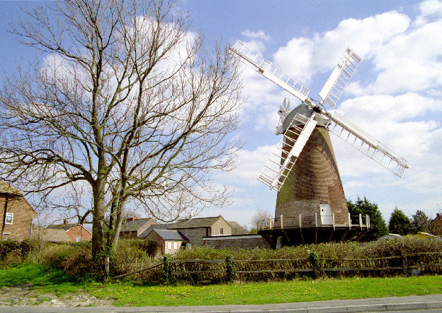
Image: © Andrew Huggett Taken: 30 Mar 1997
Polegate Windmill was built in 1817 and was originally known as ’Willingdon Mill’ until the boundaries were changed on 1 April 1939 and it became ‘Polegate Windmill’.
Images are licensed for reuse under creativecommons.org/licenses/by-sa/2.0
Image Location


Leaflet Map data © OpenStreetMap
Latitude
50.813976
Longitude
0.242832