Spen Ringway
Introduction
The photograph on this page of Spen Ringway by Alan Murray-Rust as part of the Geograph project.
The Geograph project started in 2005 with the aim of publishing, organising and preserving representative images for every square kilometre of Great Britain, Ireland and the Isle of Man.

There are currently over 7.5m images from over 14,400 individuals and you can help contribute to the project by visiting https://www.geograph.org.uk
Spen Ringway
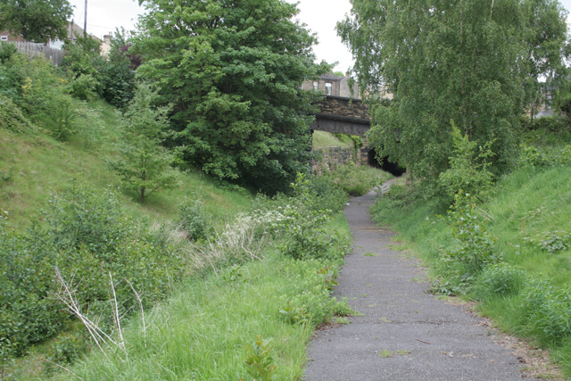
Image: © Alan Murray-Rust Taken: 20 May 2007
Both the disused railways running through Heckmondwike have been converted into cycle- and footway. This is the upper line, now part of the Spen Ringway. The lower line is the Spen Valley Greenway http://www.sustrans.org.uk/webfiles/leaflets/SPEN%20VALLEY.pdf.
Images are licensed for reuse under creativecommons.org/licenses/by-sa/2.0
Image Location
Latitude
53.710727
Longitude
-1.677108