Tala Water - Bude Canal aqueduct - stonework detail
Introduction
The photograph on this page of Tala Water - Bude Canal aqueduct - stonework detail by Colin Vosper as part of the Geograph project.
The Geograph project started in 2005 with the aim of publishing, organising and preserving representative images for every square kilometre of Great Britain, Ireland and the Isle of Man.

There are currently over 7.5m images from over 14,400 individuals and you can help contribute to the project by visiting https://www.geograph.org.uk
Tala Water - Bude Canal aqueduct - stonework detail
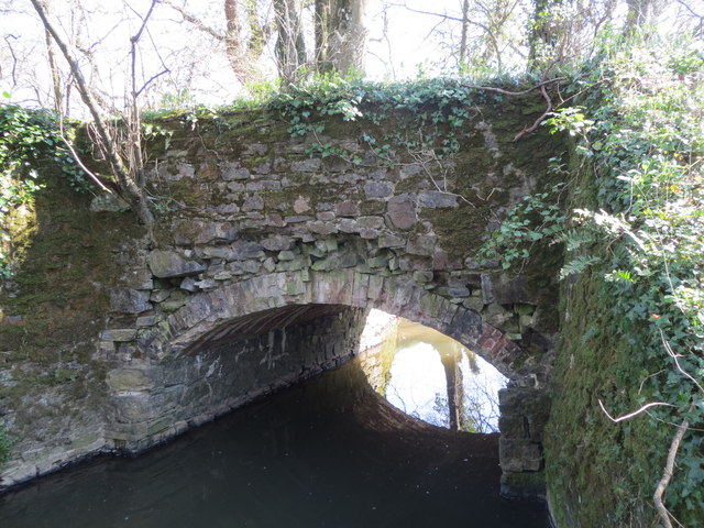
Image: © Colin Vosper Taken: 9 Apr 2015
The view shows the stone work on the west side of the supporting bridge had deteriorated and fallen away as the bonding deteriorates. The disused Bude Canal used to pass over the Tala Water via this aqueduct. Image Link to photo taken in 1978 Image
Images are licensed for reuse under creativecommons.org/licenses/by-sa/2.0
Image Location
Latitude
50.678148
Longitude
-4.348214