Demolition near the River Lea
Introduction
The photograph on this page of Demolition near the River Lea by Danny P Robinson as part of the Geograph project.
The Geograph project started in 2005 with the aim of publishing, organising and preserving representative images for every square kilometre of Great Britain, Ireland and the Isle of Man.

There are currently over 7.5m images from over 14,400 individuals and you can help contribute to the project by visiting https://www.geograph.org.uk
Demolition near the River Lea
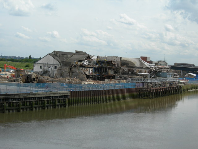
Image: © Danny P Robinson Taken: 20 May 2007
Picture taken from Bow Creek Ecology Park, east side. I don't know what this factory used to make, nor do I know what will be put here instead. Google Maps Satellite View shows this peninsula as being covered with industry but it is looking very bare now, with just this remaining.
Images are licensed for reuse under creativecommons.org/licenses/by-sa/2.0
Image Location
Latitude
51.511686
Longitude
0.004549