Wainwright Memorial Toposcope
Introduction
The photograph on this page of Wainwright Memorial Toposcope by David Dixon as part of the Geograph project.
The Geograph project started in 2005 with the aim of publishing, organising and preserving representative images for every square kilometre of Great Britain, Ireland and the Isle of Man.

There are currently over 7.5m images from over 14,400 individuals and you can help contribute to the project by visiting https://www.geograph.org.uk
Wainwright Memorial Toposcope
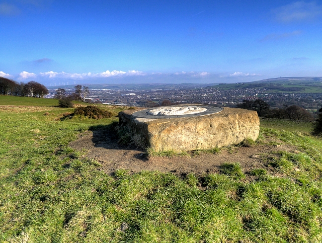
Image: © David Dixon Taken: 5 Apr 2015
This memorial for the famous fell walker, guidebook writer and illustrator Alfred Wainwright http://en.wikipedia.org/wiki/Alfred_Wainwright was unveiled on Monday 13th May 2013, on the hills above Blackburn; the town where he was born and lived until he moved to the Lake District when he was 34 and became known for his series of pictorial guides written between 1952 and 1966 The bronze directional plaque and stone relief carving of the author sculpted by Martyn Bednarczuk is found at the Yellow Hills in Pleasington, adjacent to a public footpath on the Witton Weavers’ Way. The location was chosen because on a clear day, there is an almost uninterrupted panorama of the surrounding landscape and a view to the distant Lakeland fells. The plaque indicates near and distant hills and other landmarks on the horizon that can be seen from this viewpoint. http://www.bbc.co.uk/news/uk-england-lancashire-22506762 BBC News http://www.wainwright.org.uk/articles/2013/aw-toposcope.html The Wainwright Society
Images are licensed for reuse under creativecommons.org/licenses/by-sa/2.0
Image Location
Latitude
53.746282
Longitude
-2.534011