The level crossing at Rolvenden station
Introduction
The photograph on this page of The level crossing at Rolvenden station by Marathon as part of the Geograph project.
The Geograph project started in 2005 with the aim of publishing, organising and preserving representative images for every square kilometre of Great Britain, Ireland and the Isle of Man.

There are currently over 7.5m images from over 14,400 individuals and you can help contribute to the project by visiting https://www.geograph.org.uk
The level crossing at Rolvenden station
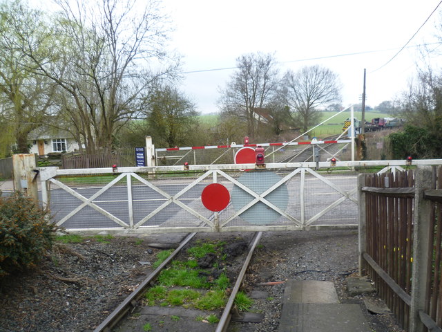
Image: © Marathon Taken: 4 Apr 2015
The original line was opened by the Rother Valley Railway between Rolvenden and Robertsbridge in 1900. At that time Rolvenden station was named Tenterden until the station up the hill was opened. The railway extended to Tenterden Town in 1903 and on to Headcorn in 1905, naming itself the Kent & East Sussex Railway in the process. The section from Tenterden Town to Headcorn closed in 1954 and Tenterden itself closed with the line in 1961. Tenterdown Town station was reopened by the Kent & East Sussex Railway on 3rd February 1974 but the line only went as far as Rolvenden. The extension to Wittersham Road came in 1977, to Northiam in 1990 and to Bodiam in 2000. This view is of the level crossing where Rolvenden Road crosses the line. Tenterden Town is up the line ahead. For more information on Rolvenden station see http://www.preservation.kesr.org.uk/stations/rolvenden
Images are licensed for reuse under creativecommons.org/licenses/by-sa/2.0
Image Location
Latitude
51.064253
Longitude
0.659556