Nantwich: Castle Street
Introduction
The photograph on this page of Nantwich: Castle Street by Christopher Hilton as part of the Geograph project.
The Geograph project started in 2005 with the aim of publishing, organising and preserving representative images for every square kilometre of Great Britain, Ireland and the Isle of Man.

There are currently over 7.5m images from over 14,400 individuals and you can help contribute to the project by visiting https://www.geograph.org.uk
Nantwich: Castle Street
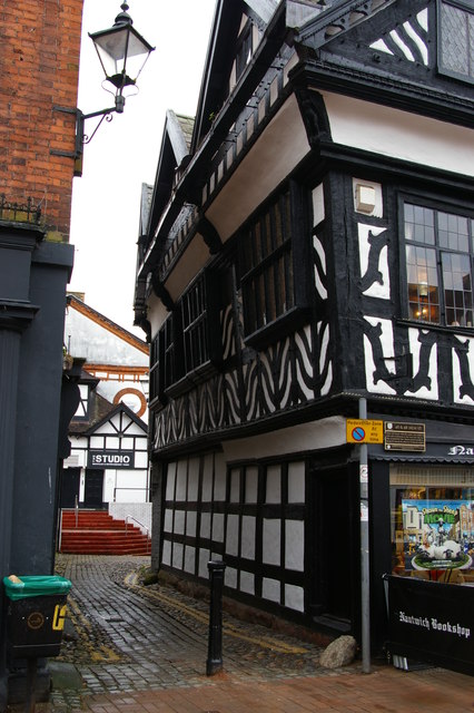
Image: © Christopher Hilton Taken: 16 Feb 2015
Traffic can get up Castle Street as far as the bollard, but is then turned back before it can enter the pedestrianized High Street. When I first knew Nantwich the situation was reversed: through traffic passed along the High Street, off which Castle Street was a short dead-end, and the only access to properties on the little street was down this narrow entrance. The construction of Nantwich's inner ring road, Water Lode, along the banks of the Weaver in the late 1970s, opened up the waterside and formerly dead-end entries such as Castle Street or the nearby Mill Street changed their orientation completely. An image of the same building a little over 50 years previously can be seen at Image
Images are licensed for reuse under creativecommons.org/licenses/by-sa/2.0
Image Location
Latitude
53.066701
Longitude
-2.522578