Railway lines at docklands
Introduction
The photograph on this page of Railway lines at docklands by Simon Johnston as part of the Geograph project.
The Geograph project started in 2005 with the aim of publishing, organising and preserving representative images for every square kilometre of Great Britain, Ireland and the Isle of Man.

There are currently over 7.5m images from over 14,400 individuals and you can help contribute to the project by visiting https://www.geograph.org.uk
Railway lines at docklands
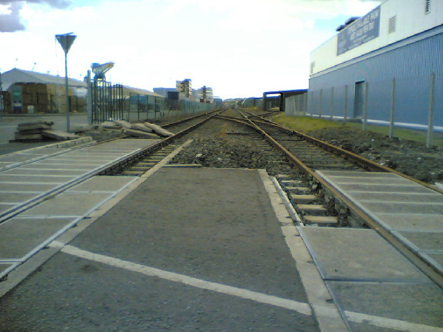
Image: © Simon Johnston Taken: 25 Aug 2005
Disused for most of the time. These lines would have been busy during the heydays of the Dockyard. Heavy Duty crane dockside left. Industrial units are springing up (typical:right) all over the docks as the Dockyard begins to make up for the reduced Royal Naval activity. Merchant vessels appear more frequent these days and probably account for some of the renewed activity, especially the Zeebrugge Superfast ferry.
Images are licensed for reuse under creativecommons.org/licenses/by-sa/2.0
Image Location


Leaflet Map data © OpenStreetMap
Latitude
56.027011
Longitude
-3.437631