Wooden enclosure
Introduction
The photograph on this page of Wooden enclosure by John Baker as part of the Geograph project.
The Geograph project started in 2005 with the aim of publishing, organising and preserving representative images for every square kilometre of Great Britain, Ireland and the Isle of Man.

There are currently over 7.5m images from over 14,400 individuals and you can help contribute to the project by visiting https://www.geograph.org.uk
Wooden enclosure
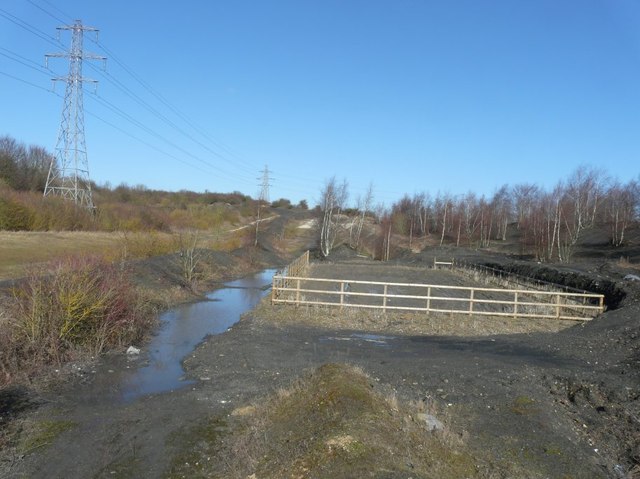
Image: © John Baker Taken: 27 Feb 2015
Beside the spoil heap of the former Tilmanstone Colliery. I’ve no idea of its significance but it may form part of the future development of the site. Planning permission has been granted by Dover District Council under application number DOV/13/00654 for “A) full application for the re-contouring of the spoil and restoration of the former Colliery, proposed siting of a photovoltaic array (10 MW), restoration of the former railway halt including siting a visitor interpretation boards and rock store, landscaping and ecological works and footpath link and B) outline application for the siting of industrial units (Class B2) (10,000 sq m GEA) with all matters reserved, with the exception of layout, scale, associated car parking and means of access (amended and additional details)”. This is a similar scheme to that found near Betteshanger, which has now become Fowlmead Country Park in Image
Images are licensed for reuse under creativecommons.org/licenses/by-sa/2.0
Image Location
Latitude
51.209779
Longitude
1.266492