Towards Kilmarnock Town Centre
Introduction
The photograph on this page of Towards Kilmarnock Town Centre by allan mcdougall as part of the Geograph project.
The Geograph project started in 2005 with the aim of publishing, organising and preserving representative images for every square kilometre of Great Britain, Ireland and the Isle of Man.

There are currently over 7.5m images from over 14,400 individuals and you can help contribute to the project by visiting https://www.geograph.org.uk
Towards Kilmarnock Town Centre
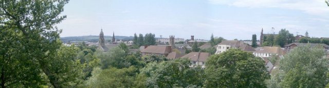
Image: © allan mcdougall Taken: Unknown
View of the town from the Kay Park near Burns Monument, looking South West. Left To Right. The High Church, The Grange Kirk, The West High Kirk, Kilmarnock Railway Station, St Joseph's Church and Johnnie Walkers.
Images are licensed for reuse under creativecommons.org/licenses/by-sa/2.0
Image Location


Leaflet Map data © OpenStreetMap
Latitude
55.613445
Longitude
-4.493481