St Mary Magdalene school
Introduction
The photograph on this page of St Mary Magdalene school by David Anstiss as part of the Geograph project.
The Geograph project started in 2005 with the aim of publishing, organising and preserving representative images for every square kilometre of Great Britain, Ireland and the Isle of Man.

There are currently over 7.5m images from over 14,400 individuals and you can help contribute to the project by visiting https://www.geograph.org.uk
St Mary Magdalene school
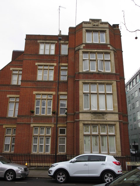
Image: © David Anstiss Taken: 8 Mar 2015
This large red building is on the corner of Osnaburgh Street (in front) and Longford Street. It is a Grade II listed building, built in 1901. See http://www.britishlistedbuildings.co.uk/en-478728-st-mary-magdalene-school-annexe-and-atta for more details about the building.
Images are licensed for reuse under creativecommons.org/licenses/by-sa/2.0
Image Location


Leaflet Map data © OpenStreetMap
Latitude
51.525714
Longitude
-0.142888