Redan Hill, Aldershot
Introduction
The photograph on this page of Redan Hill, Aldershot by Alan Hunt as part of the Geograph project.
The Geograph project started in 2005 with the aim of publishing, organising and preserving representative images for every square kilometre of Great Britain, Ireland and the Isle of Man.

There are currently over 7.5m images from over 14,400 individuals and you can help contribute to the project by visiting https://www.geograph.org.uk
Redan Hill, Aldershot
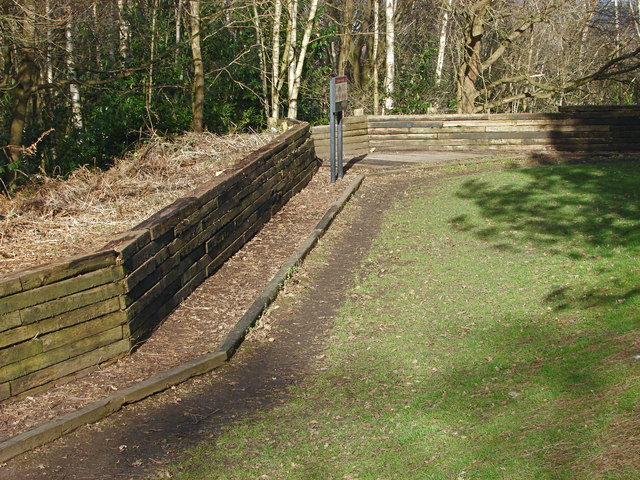
Image: © Alan Hunt Taken: 4 Mar 2015
Part of the wooden balustrade around the top of the redan. The undergrowth has recently been cleared giving a clear view of the defensive works. A redan was a defensive work that was open to the rear whereas a redoubt was totally enclosed.
Images are licensed for reuse under creativecommons.org/licenses/by-sa/2.0
Image Location
Latitude
51.249441
Longitude
-0.751697