Settle from Castlebergh Viewpoint
Introduction
The photograph on this page of Settle from Castlebergh Viewpoint by John S Turner as part of the Geograph project.
The Geograph project started in 2005 with the aim of publishing, organising and preserving representative images for every square kilometre of Great Britain, Ireland and the Isle of Man.

There are currently over 7.5m images from over 14,400 individuals and you can help contribute to the project by visiting https://www.geograph.org.uk
Settle from Castlebergh Viewpoint
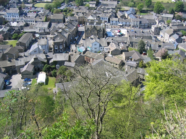
Image: © John S Turner Taken: 1 May 2007
Looking down on Settle from Castlebergh where the English flag flies - see Image The Town Hall, which is just into the next square, can be seen with its plentiful array of chimneys in the centre of the photo. To the right of the Town Hall the regular Tuesday market is taking place. All the buildings on this side of the Town Hall are in this square.
Images are licensed for reuse under creativecommons.org/licenses/by-sa/2.0
Image Location
Latitude
54.068468
Longitude
-2.276385