Waun Street desolation in Abergwynfi
Introduction
The photograph on this page of Waun Street desolation in Abergwynfi by Jaggery as part of the Geograph project.
The Geograph project started in 2005 with the aim of publishing, organising and preserving representative images for every square kilometre of Great Britain, Ireland and the Isle of Man.

There are currently over 7.5m images from over 14,400 individuals and you can help contribute to the project by visiting https://www.geograph.org.uk
Waun Street desolation in Abergwynfi
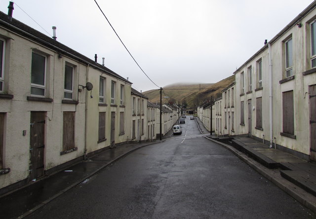
Image: © Jaggery Taken: 25 Feb 2015
One definition of desolation is "deprived of inhabitants" which is an apt description of Waun Street in February 2015. Many (but not all) houses are boarded up. There are similar scenes in adjacent Scotch Street and Chapel Street.
Images are licensed for reuse under creativecommons.org/licenses/by-sa/2.0
Image Location
Latitude
51.6525
Longitude
-3.600541