Louth town centre: aerial 2015
Introduction
The photograph on this page of Louth town centre: aerial 2015 by Chris as part of the Geograph project.
The Geograph project started in 2005 with the aim of publishing, organising and preserving representative images for every square kilometre of Great Britain, Ireland and the Isle of Man.

There are currently over 7.5m images from over 14,400 individuals and you can help contribute to the project by visiting https://www.geograph.org.uk
Louth town centre: aerial 2015
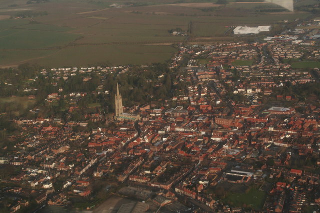
Image: © Chris Taken: 22 Feb 2015
St. James' Church. Indoor market's clock tower below the church, and on the corner of the Cornmarket. Top left of the spire is the St. Mary's Lane area. Louth County Hospital to the right of the A16, which winds its way up to the top left corner. Town Hall right of the church (big red brick building). Co-op store centre right. Cattle market just visible centre bottom, though not for much longer, for East Lindsey District Council has agreed to sell it for development as a supermarket. Above that, Newmarket curves across the shot, with the Newmarket Carpark above the cattle market, and the Boar's Head Pub on its right corner. The green patch right of that is Kidgate School.
Images are licensed for reuse under creativecommons.org/licenses/by-sa/2.0
Image Location
Latitude
53.366599
Longitude
-0.00503