Vacant buildings, Donegall Road, Belfast (February 2015)
Introduction
The photograph on this page of Vacant buildings, Donegall Road, Belfast (February 2015) by Albert Bridge as part of the Geograph project.
The Geograph project started in 2005 with the aim of publishing, organising and preserving representative images for every square kilometre of Great Britain, Ireland and the Isle of Man.

There are currently over 7.5m images from over 14,400 individuals and you can help contribute to the project by visiting https://www.geograph.org.uk
Vacant buildings, Donegall Road, Belfast (February 2015)
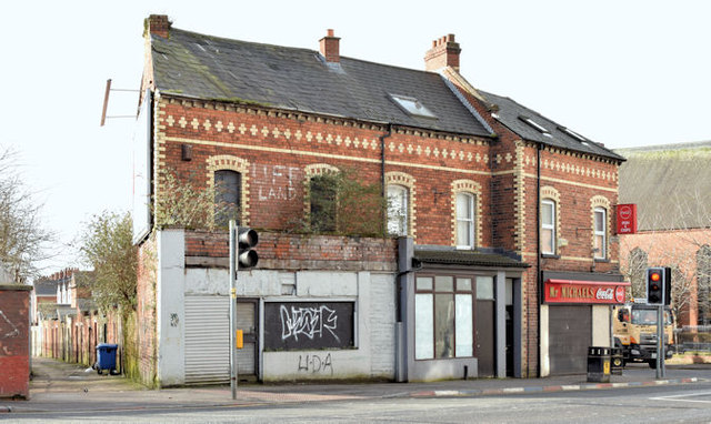
Image: © Albert Bridge Taken: 23 Feb 2015
Two vacant and semi-derelict former houses (nos 266 & 268), converted to shops, opposite Roden Street. I cannot find any reference to a planning application for demolition or renovation. To avoid any confusion the chippy (right, at the corner of Donegall Avenue) is no 270 and is open for business.
Images are licensed for reuse under creativecommons.org/licenses/by-sa/2.0
Image Location
Latitude
54.588842
Longitude
-5.949224