Bermuda Road, Griff, 1982
Introduction
The photograph on this page of Bermuda Road, Griff, 1982 by John Brightley as part of the Geograph project.
The Geograph project started in 2005 with the aim of publishing, organising and preserving representative images for every square kilometre of Great Britain, Ireland and the Isle of Man.

There are currently over 7.5m images from over 14,400 individuals and you can help contribute to the project by visiting https://www.geograph.org.uk
Bermuda Road, Griff, 1982
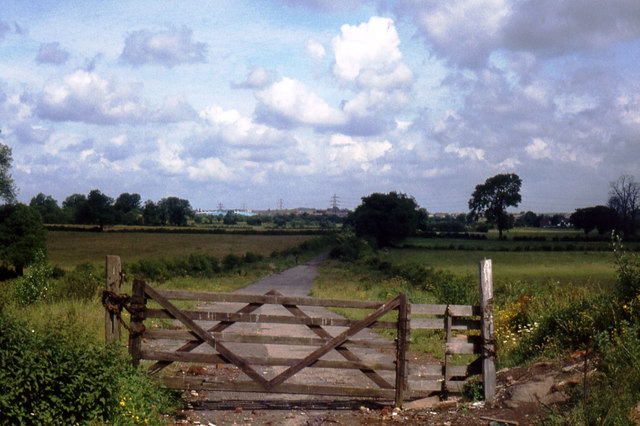
Image: © John Brightley Taken: Unknown
Bermuda Road looking from Griff Lane to Bermuda. It is remarkable how this location changed in the subsequent 25 years - nothing in this view exists today- apart from the industrial buildings in the far background which are on Hazell Way. In approximately 1985 to 1989 all of this area was excavated as an opencast coal mine, and subsequently the area was developed as the industrial estate which exists today.
Images are licensed for reuse under creativecommons.org/licenses/by-sa/2.0
Image Location
Latitude
52.498025
Longitude
-1.478214