Disused road
Introduction
The photograph on this page of Disused road by Robert Ashby as part of the Geograph project.
The Geograph project started in 2005 with the aim of publishing, organising and preserving representative images for every square kilometre of Great Britain, Ireland and the Isle of Man.

There are currently over 7.5m images from over 14,400 individuals and you can help contribute to the project by visiting https://www.geograph.org.uk
Disused road
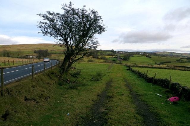
Image: © Robert Ashby Taken: 7 Feb 2015
At one time the Ballymena to Larne Road must have followed this straight line and the section still in use for local access can be seen in the distance. For some reason it appears to have been diverted to the left to curve round in a loop and rejoin the original line at the far end. Most roads are realigned to remove bends but this one has had a straight section cut off and a bend inserted. On the satellite image the original line can be seen meeting the still existing eastern section halfway. Maybe someone with a knowledge of local history can throw some light on this apparent anomaly.
Images are licensed for reuse under creativecommons.org/licenses/by-sa/2.0
Image Location
Latitude
54.828747
Longitude
-6.093015