Trig point at Yorkley Slade
Introduction
The photograph on this page of Trig point at Yorkley Slade by Philip Halling as part of the Geograph project.
The Geograph project started in 2005 with the aim of publishing, organising and preserving representative images for every square kilometre of Great Britain, Ireland and the Isle of Man.

There are currently over 7.5m images from over 14,400 individuals and you can help contribute to the project by visiting https://www.geograph.org.uk
Trig point at Yorkley Slade
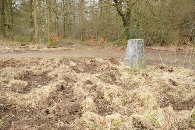
Image: © Philip Halling Taken: 7 Feb 2015
This trig point is on the southern edge of the Forest of Dean at Yorkley Slade. Wild boar are now widespread in the Forest of Dean with an estimated 800 at large, evidence of these animals is very apparent such as the ground around this trig point which has been routed.
Images are licensed for reuse under creativecommons.org/licenses/by-sa/2.0
Image Location
Latitude
51.764386
Longitude
-2.522759