Former Unitarian Chapel
Introduction
The photograph on this page of Former Unitarian Chapel by Ian Capper as part of the Geograph project.
The Geograph project started in 2005 with the aim of publishing, organising and preserving representative images for every square kilometre of Great Britain, Ireland and the Isle of Man.

There are currently over 7.5m images from over 14,400 individuals and you can help contribute to the project by visiting https://www.geograph.org.uk
Former Unitarian Chapel
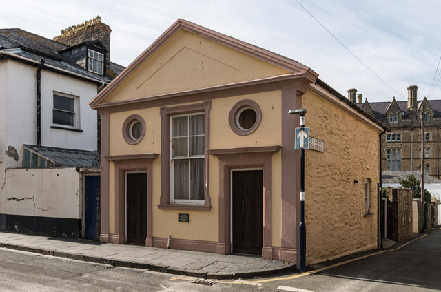
Image: © Ian Capper Taken: 6 Sep 2014
Situated on the corner of New Street and Castle Street, this chapel was adopted by the Unitarians around 1906. It had been built in around 1810 and had previously served as an estate office for the Nanteos Estate, a stable/coach house, then, from 1853, a Quaker Meeting House, and finally a bookshop in the late 19th Century. It ceased to be used as a chapel in 1976. Grade II listed - see http://cadwpublic-api.azurewebsites.net/reports/listedbuilding/FullReport?lang=en&id=10322.
Images are licensed for reuse under creativecommons.org/licenses/by-sa/2.0
Image Location
Latitude
52.414387
Longitude
-4.087409