Victorian postbox detail, Stafford Road, Griffithstown, Pontypool
Introduction
The photograph on this page of Victorian postbox detail, Stafford Road, Griffithstown, Pontypool by Jaggery as part of the Geograph project.
The Geograph project started in 2005 with the aim of publishing, organising and preserving representative images for every square kilometre of Great Britain, Ireland and the Isle of Man.

There are currently over 7.5m images from over 14,400 individuals and you can help contribute to the project by visiting https://www.geograph.org.uk
Victorian postbox detail, Stafford Road, Griffithstown, Pontypool
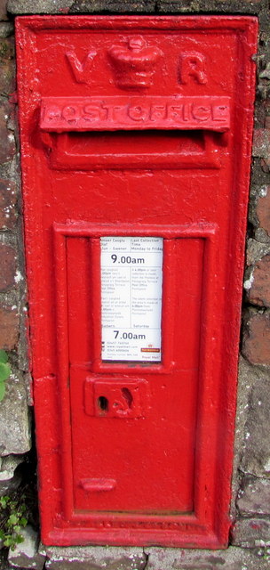
Image: © Jaggery Taken: 27 Jan 2015
Located here. http://www.geograph.org.uk/photo/4325626 In common with many other locations, in January 2015 the last collection from this box is early each day. On Mondays-Fridays last collection is 9am, and 7am on Saturdays. The white notice states that on Mondays-Fridays, a 4pm or later collection is made from the postbox at Penygraig Terrace Post Office. The latest collection in the area is made at 6pm from Pontnewynydd Pontypool.
Images are licensed for reuse under creativecommons.org/licenses/by-sa/2.0
Image Location
Latitude
51.692714
Longitude
-3.028442