Approaching St. Margarets
Introduction
The photograph on this page of Approaching St. Margarets by Martin Addison as part of the Geograph project.
The Geograph project started in 2005 with the aim of publishing, organising and preserving representative images for every square kilometre of Great Britain, Ireland and the Isle of Man.

There are currently over 7.5m images from over 14,400 individuals and you can help contribute to the project by visiting https://www.geograph.org.uk
Approaching St. Margarets
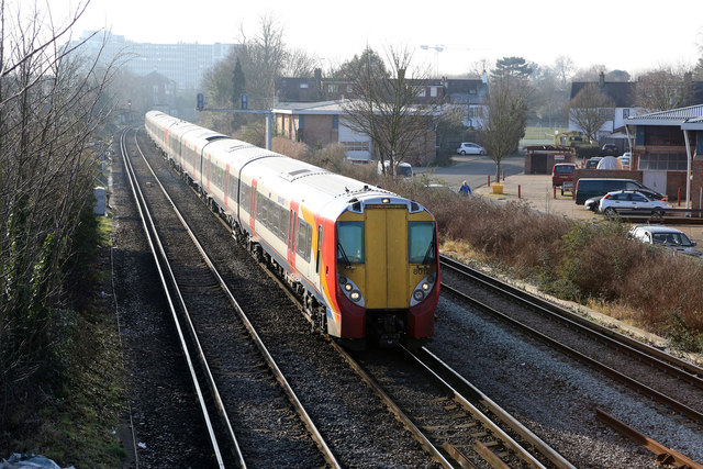
Image: © Martin Addison Taken: 23 Jan 2015
Seen from the footbridge connecting Amyand Park Road with Winchester Road/ Drummond Place, a brace of class 458 electric units (8012 leading) approach St Margarets station with a semi-fast service from Windsor & Eton Riverside to Waterloo. On the right is a business centre located on Drummond Place.
Images are licensed for reuse under creativecommons.org/licenses/by-sa/2.0
Image Location
Latitude
51.453519
Longitude
-0.322854