Tettenhall station
Introduction
The photograph on this page of Tettenhall station by John Winder as part of the Geograph project.
The Geograph project started in 2005 with the aim of publishing, organising and preserving representative images for every square kilometre of Great Britain, Ireland and the Isle of Man.

There are currently over 7.5m images from over 14,400 individuals and you can help contribute to the project by visiting https://www.geograph.org.uk
Tettenhall station
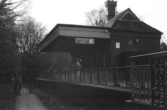
Image: © John Winder Taken: 7 Dec 2014
Formerly used as a ranger station but now open as a tea room. The station opened (with two platforms, one of which never had track laid to serve it and was never used) in 1925 and closed in 1932. The site is remarkably complete: the goods shed, weighbridge hut and both platforms survive.
Images are licensed for reuse under creativecommons.org/licenses/by-sa/2.0
Image Location
Latitude
52.596423
Longitude
-2.162056