Stanley Mills, Perthshire; Mid Mill, Level 2
Introduction
The photograph on this page of Stanley Mills, Perthshire; Mid Mill, Level 2 by Michael Garlick as part of the Geograph project.
The Geograph project started in 2005 with the aim of publishing, organising and preserving representative images for every square kilometre of Great Britain, Ireland and the Isle of Man.

There are currently over 7.5m images from over 14,400 individuals and you can help contribute to the project by visiting https://www.geograph.org.uk
Stanley Mills, Perthshire; Mid Mill, Level 2
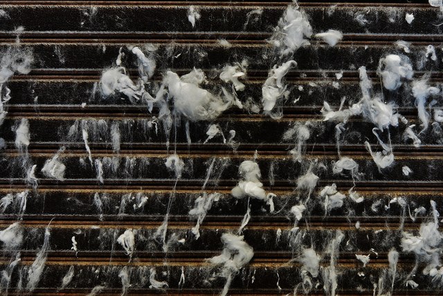
Image: © Michael Garlick Taken: 4 Jul 2014
Carding Machine face detail. These machines were used to process rolls of cotton fibres into long, fat ropes called "slivers" or "slubbing". These were then stretched on drawing machines until they were thin enough to spin.
Images are licensed for reuse under creativecommons.org/licenses/by-sa/2.0
Image Location
Latitude
56.478944
Longitude
-3.440387