Cavers House
Introduction
The photograph on this page of Cavers House by James T M Towill as part of the Geograph project.
The Geograph project started in 2005 with the aim of publishing, organising and preserving representative images for every square kilometre of Great Britain, Ireland and the Isle of Man.

There are currently over 7.5m images from over 14,400 individuals and you can help contribute to the project by visiting https://www.geograph.org.uk
Cavers House
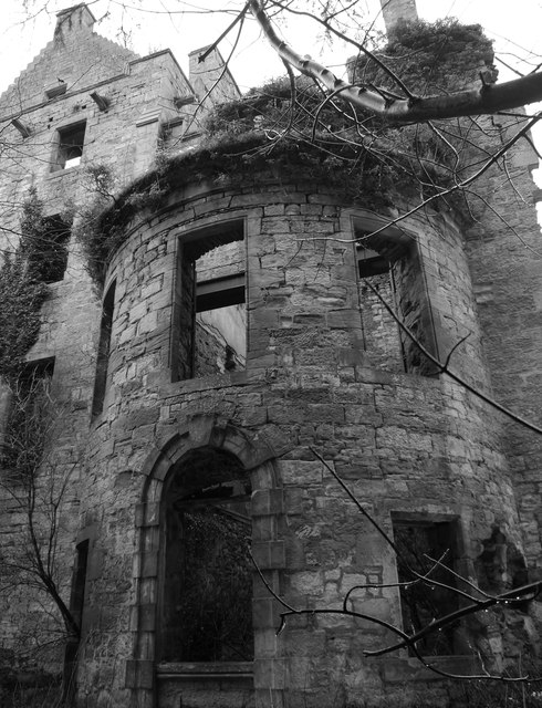
Image: © James T M Towill Taken: 11 Jan 2015
A view of the 'advanced bow' to the east of the ruins. The house dates from approximately 1500 with subsequent additions and remodelling over nearly the next 400 years. The ruins have been roofless since approximately 1953. See http://www.buildingsatrisk.org.uk/details/893098 for further information.
Images are licensed for reuse under creativecommons.org/licenses/by-sa/2.0
Image Location
Latitude
55.430957
Longitude
-2.727505